Reserve from the case
Shipping Estimate
USA
- USA
- CAN
- USA
- CAN
Ships within 48 hours · Estimated delivery Oct 3 - Oct 8
Reserve from the case
Ships within 48 hours · Estimated delivery Oct 3 - Oct 8
up-to-date cartography
The classically styled ROYAL map has a beige-ocean which calls to mind old fashioned cartography
and the lines of Latitude and Longitude
The NOAA Nautical Chart 13209: Block Island Sound and Gardiners Bay
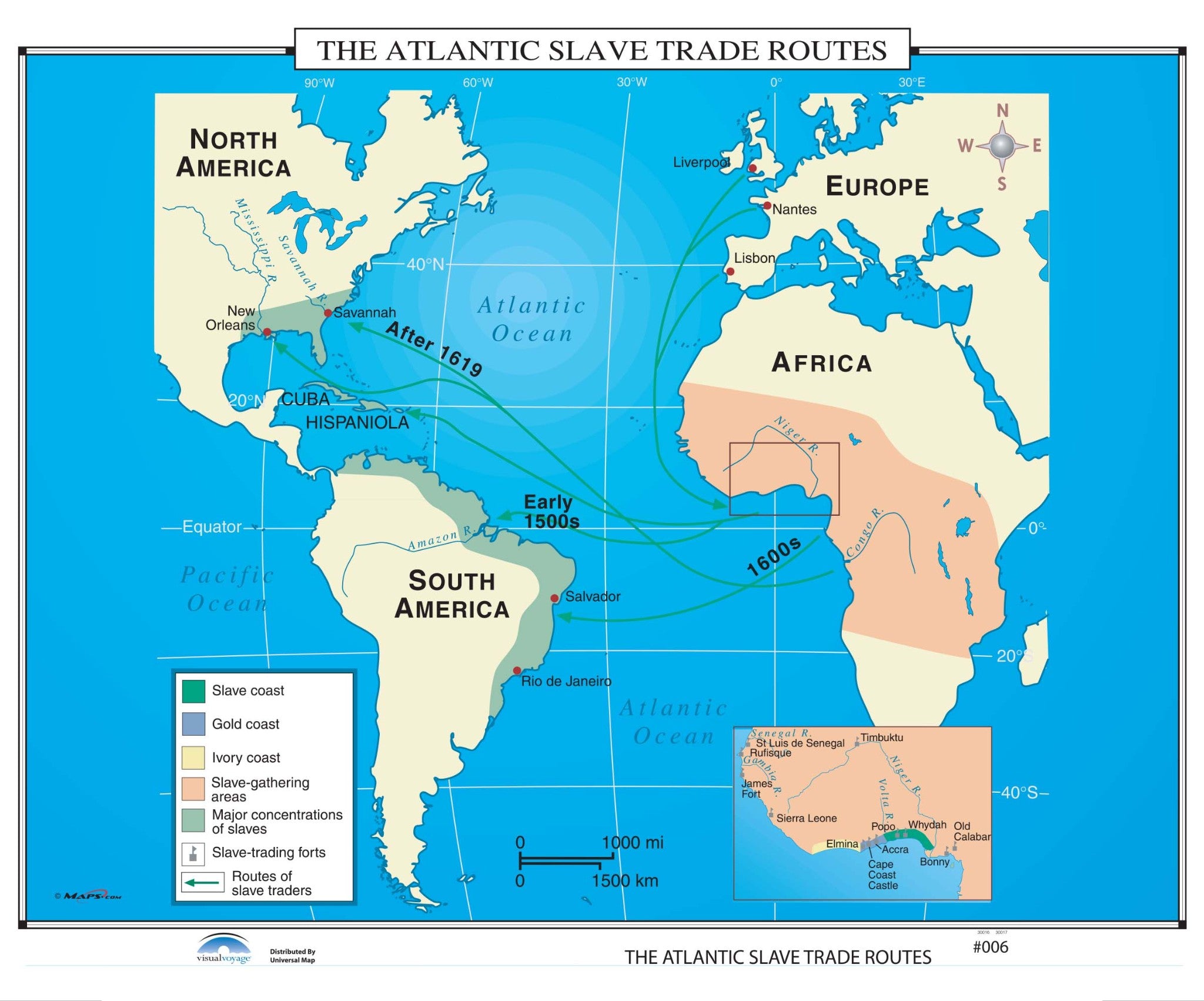
#006 The Atlantic Slave Trade Routes Finishing:Paper up-to-date cartographyThe shaded areas on The Atlantic Slave Trade Routes wall map identify the Slave, Gold, and Ivory Coasts; along with slave gathering areas, major concentrations of slaves, slave trading forts, and the routes of the slave traders.


Pay in 4 interest-free payments of $20.00 Learn more